Port of Long Beach releases the Deep Draft Navigation Integrated Feasibility Report
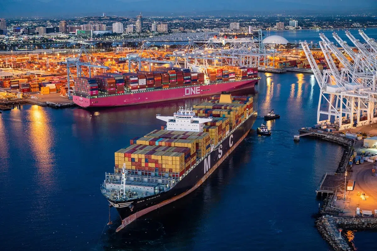
This Final Integrated Feasibility Report with Environmental Impact Statement/Environmental Impact Report (IFR) presents a summary of the planning process, describes the affected environmental resources and evaluates the potential impacts to those resources as a result of constructing, operating and maintaining the Port of Long Beach Deep Draft Navigation Project.
The Federal lead agency responsible for implementing the National Environmental Policy Act is the U.S. Army Corps of Engineers Los Angeles District. The lead agency responsible for implementing the California Environmental Quality Act is the Port of Long Beach.
The POLB is on the coast of southern California in San Pedro Bay, approximately 20 miles south of downtown Los Angeles, California. The study area includes the waters in the immediate vicinity (and shoreward) of the breakwaters through the entire Port of Long Beach, including Outer Harbor, Inner Harbor, Cerritos Channel, West Basin, and the Back Channel.
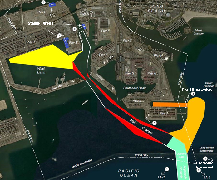
The primary problem is existing channel depths and widths that create limitations of the harbor, resulting in the inefficient operation of deep draft vessels in the Federal (Main) and secondary channels in the POLB, which increases the Nation’s transportation costs.
A range of measures and preliminary alternatives were developed during the feasibility study process in coordination with the POLB, in addition to the No Action Alternative. Four action alternatives were evaluated and vary based on a range of depths for containers and for liquid bulk measures.
For the container vessel measures, depths considered for each basin ranged between -53 feet and -57 feet mean lower low water (MLLW) to determine the net benefits yielded by each basin depth. Similar to the container vessel improvements, the liquid bulk measures considered depths for the Approach Channel ranging between -78 feet to -83 feet MLLW.
The National Economic Development plan is identified as Alternative 3, which includes the following navigation improvements:
Deepen the entrance to the Main Channel (the Approach Channel through Queens Gate) from a project depth of -76 feet to -80 feet MLLW.
Widen portions of the Main Channel (bend easing) to a depth of -76 feet MLLW.
Construct an approach channel and turning basin to Pier J South from -50 feet MLLW to a depth of -55 feet MLLW.
Deepen portions of the West Basin and West Basin Approach from -50 feet to a depth of -55 feet MLLW.
Deepen the Pier J Basin and berths J266-J270 within the Pier J South Slip to a depth of -55 feet MLLW.
Perform structural improvements on Pier J breakwaters at the entrance of the Pier J Slip to accommodate deepening of the Pier J Slip and Approach Channel to -55 feet MLLW.
Place dredged material either at a nearshore placement site, an ocean-dredged material disposal site (LA-2 and/or LA-3), or a combination of the two.
Construct a new dredge electric substation.


